#SpatialDesign #LandscapeArchitecture
The Living Edge
; adaptive city to climate changeHarvard Gruadate School of Design | 2017
Instructor: Montserrat Bonvehi Rosich
Team: Hanna Ruth, Bailun Zhang
Duration: 3 months
Role: Ideation, Plan, Rendering, Diagram, Prototyping
Tool: ArcGIS, Rhino, Grasshopper, Adobe Illustrator, Adobe Photoshop
Model Making: CNC, Laser Cutting
> How might we design the city more resilient to climate change?

>> The strategy of the stormwater filtering channel system created the structure of the plan, and the tidal pool is used as the indicators of sea level rise.
Description
This project focuses on adapting the City of Boston to the impacts of climate change through the expansion and transformation of the edge. The edge is defined as the meeting of two conditions where the interaction between them is intensified such that a new condition emerges, unique to that edge.
The idea of the rocky coast and tidal pool helped to define the pattern of the plan, and the strategy of the stormwater filtering channel system created the structure of the plan. Under this pattern and structure, different elements and infrastructures are added on top of this surface to enrich this built environment. It is maximized for the interactions of edges between soft and hard, public and private and stable and dynamic.
Background
Background
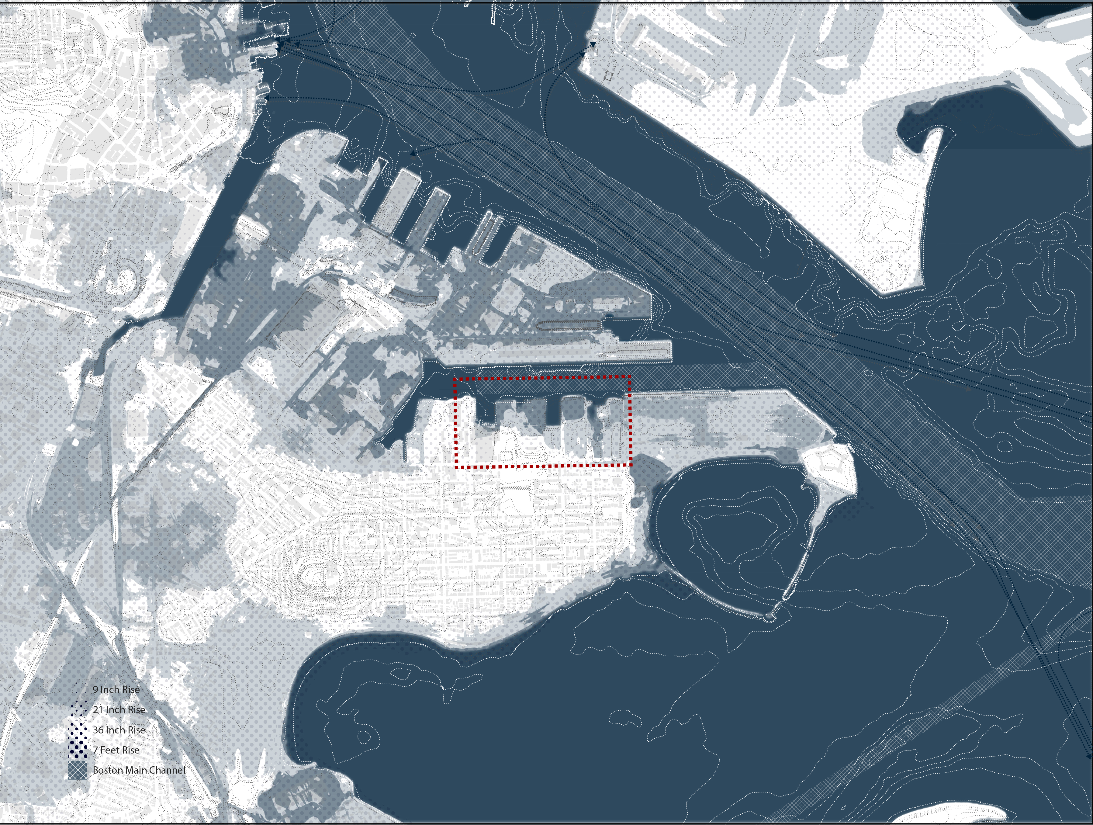
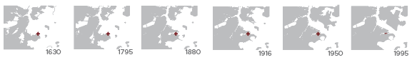
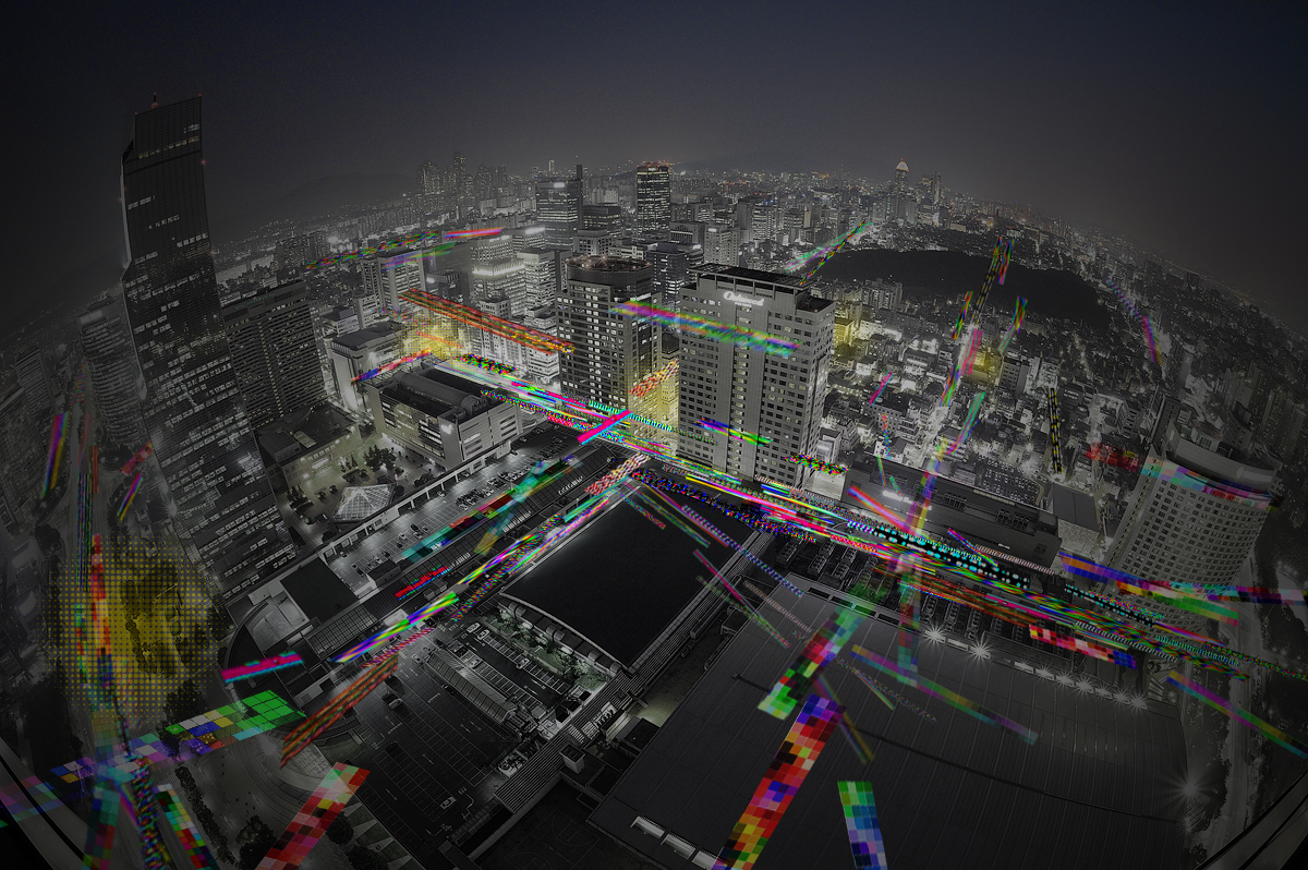
Boston is highly susceptible to the negative impacts of climate change due to its proximity to the ocean and the extensive filling of wetland and coastal waters. Storm surge from hurricanes, sea level rise, and more frequent and intense rain storms threaten to flood much of the city, including our site along the Reserve Channel in South Boston.

Strategy: Edge
When the edge between what is land and what is water is distorted due to climate change, it becomes necessary to design a new edge: one that can react and adapt to change without jeopardizing those who live at the edge.

︎︎︎ Go Back
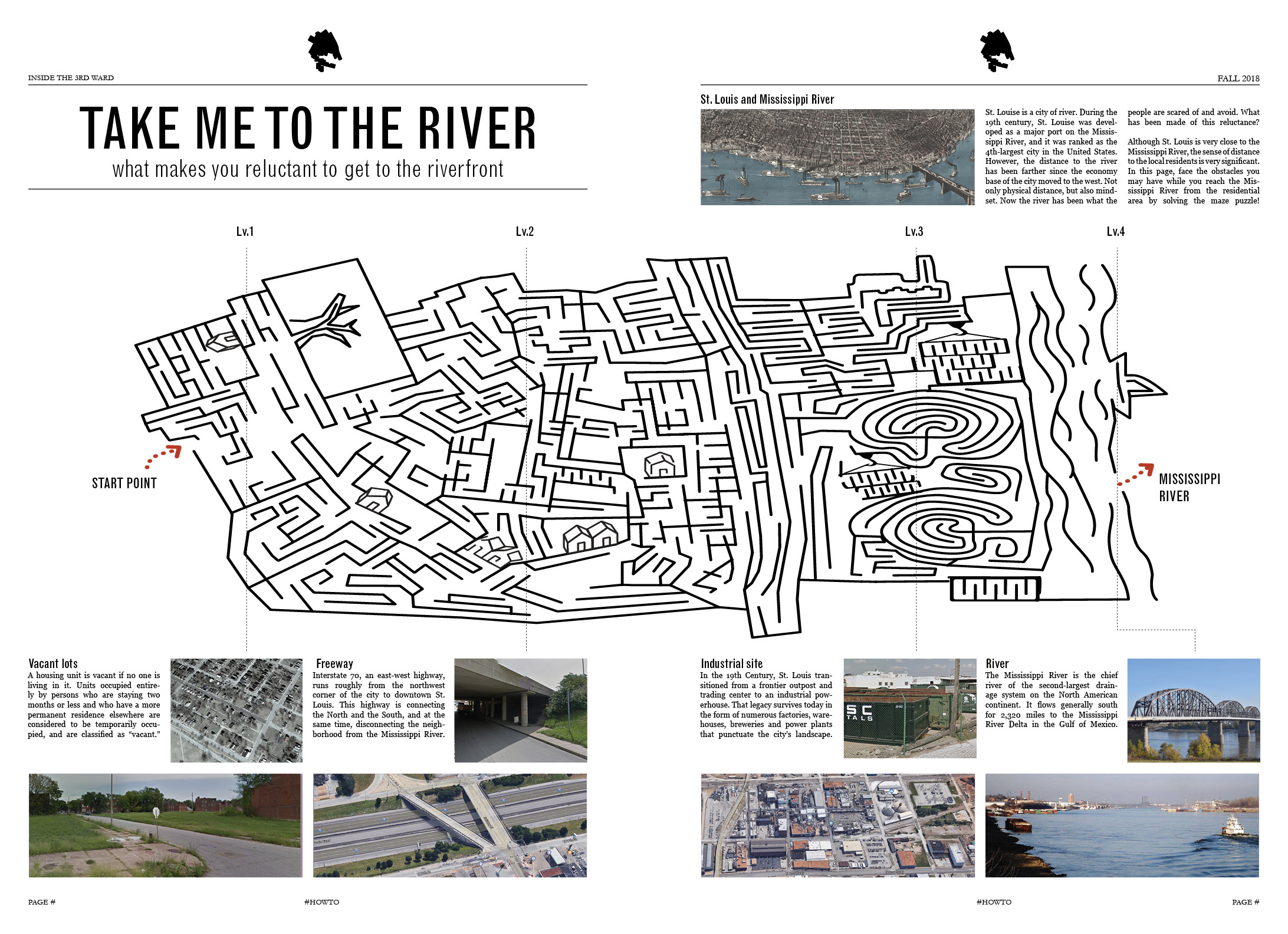
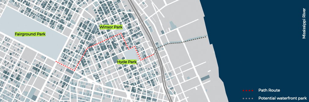
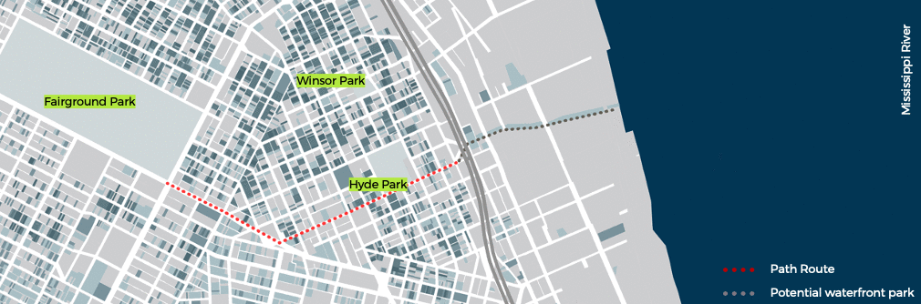
Take Me to the River
Harvard Graduate School of Design | 2018
Instructor: Daniel D’Oca
Duration: 3 months
Tools: ArcGIS, Rhino, Adobe Illustrator, Adobe Photoshop, Adobe XD
> How might we redesign the neighborhood as having the community engaged?
| Problem |
The Ward 3 neighborhood is often ignored and undermanaged by the city government. The vacancy rate is getting higher, and the level of trust from the public is low.
| Goal |
Creating a gamified community-engaged-plan to improve the neighborhood infrastructure.
>> Having them in the gamified process to have the affection and the ownership
Background
 Newspapers were made and distributed over the neighborhood Ward 3.
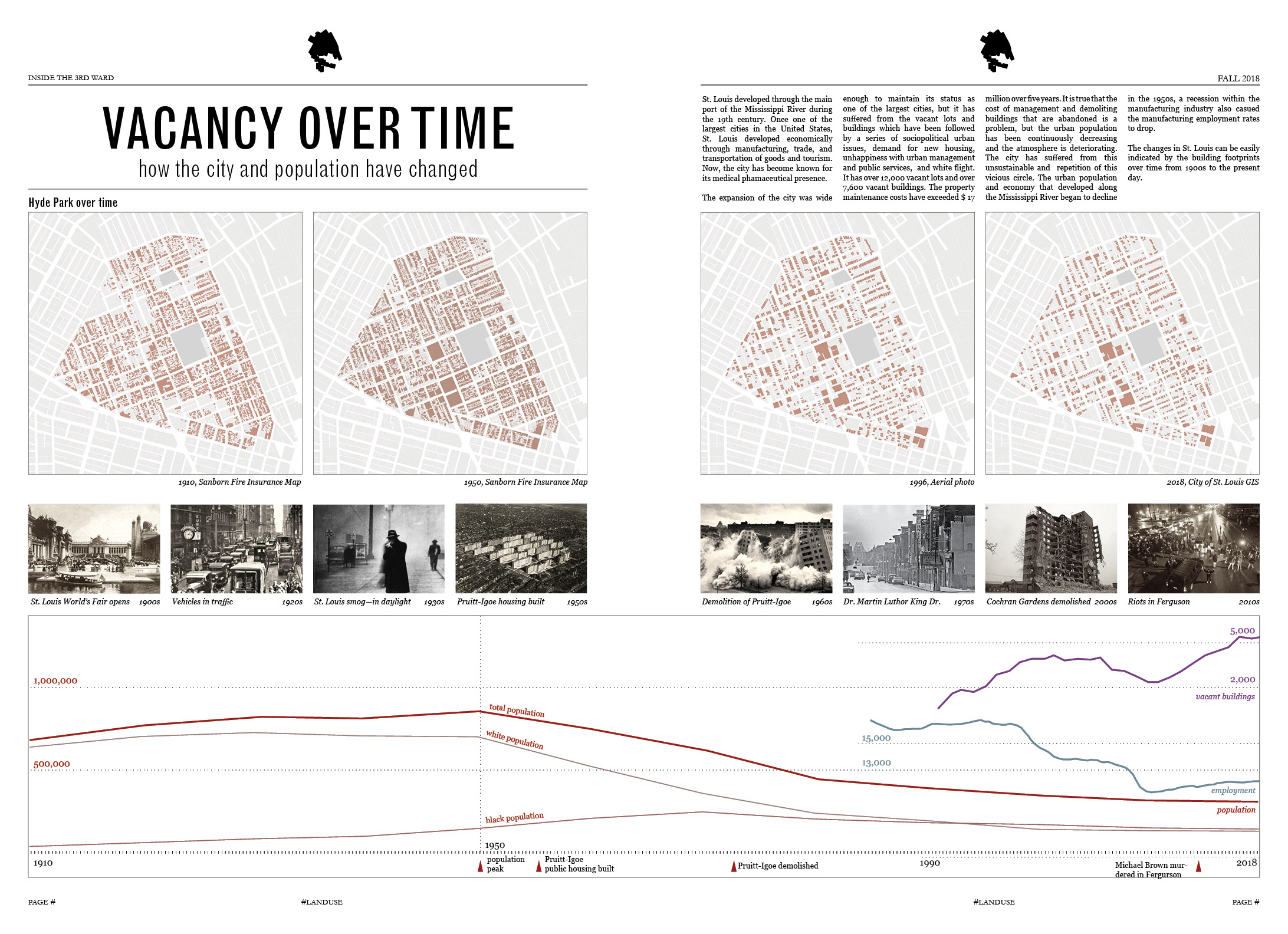
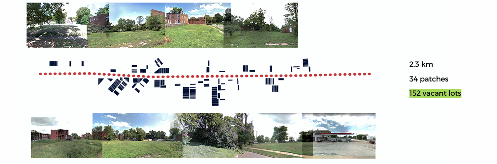
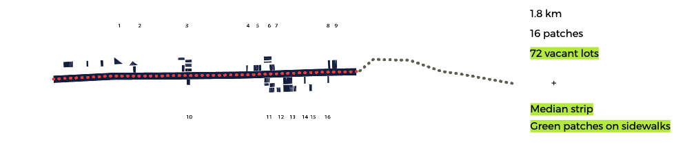
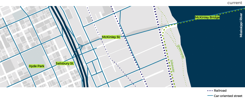
| Vacancy |
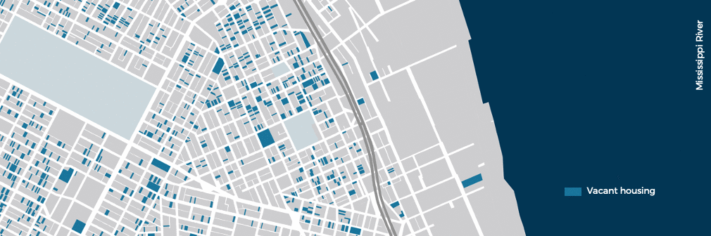
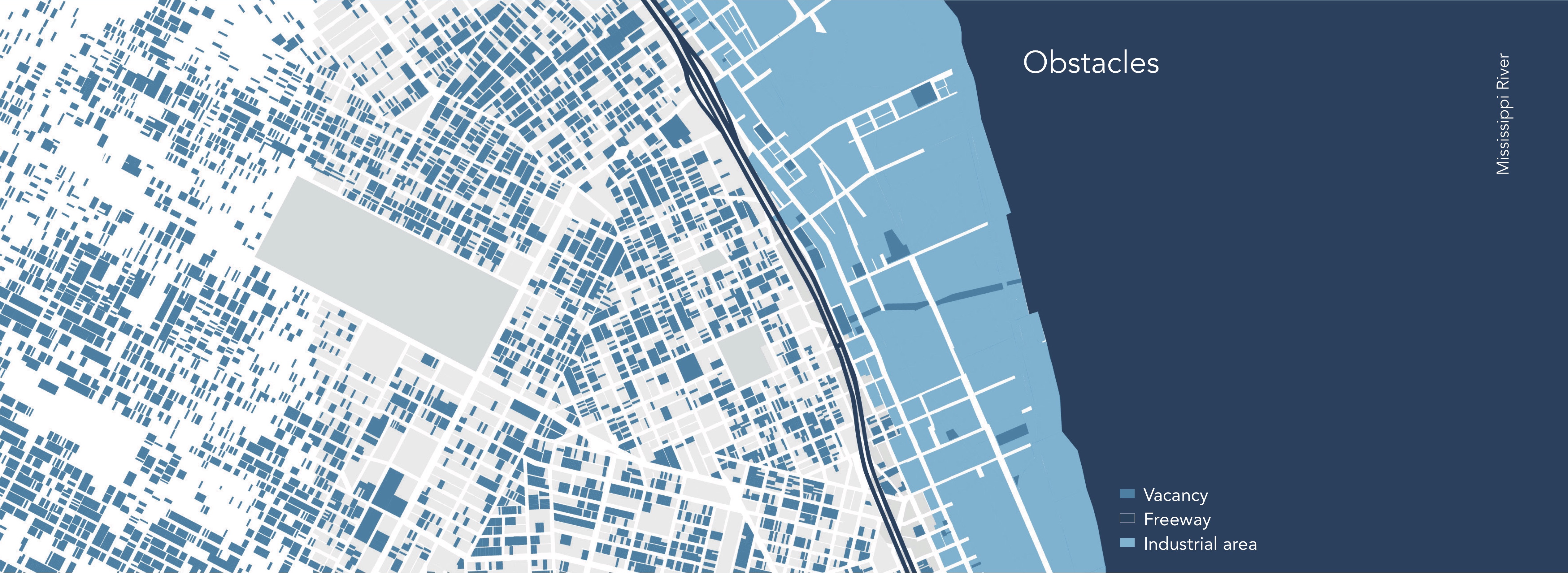
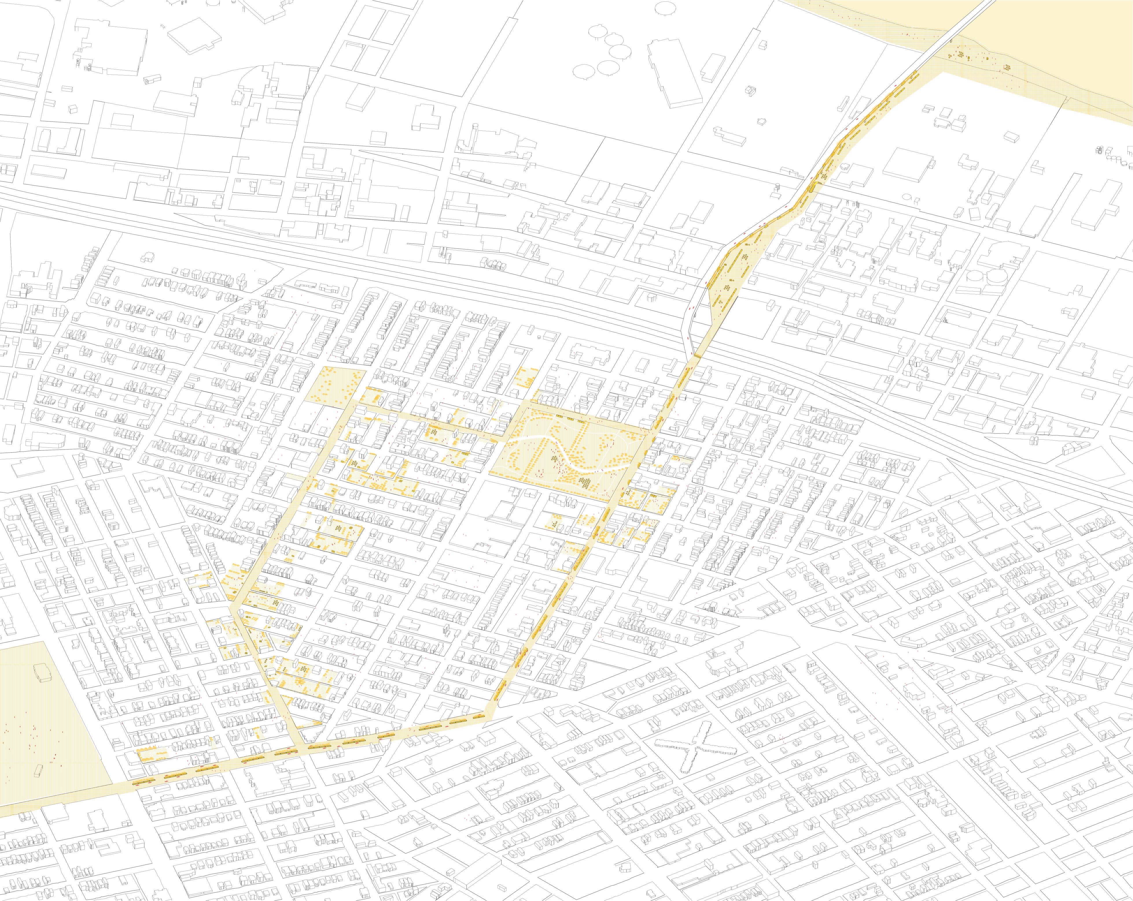
Vacancy, freeway, and industrial area prevent the residents from access to the river.
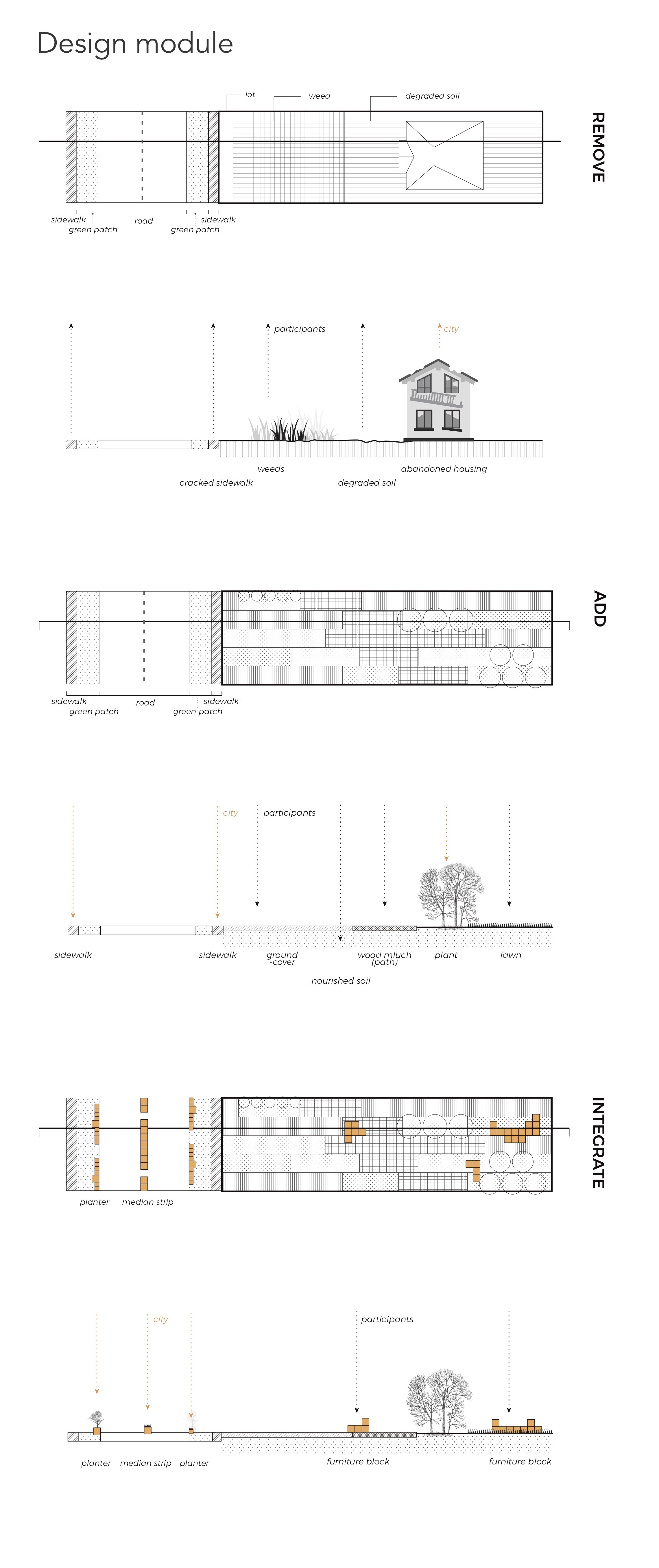
Leverage the vacant lots
| Green patches |
Converting the vacant lots to green patches
| Walkable streets |
| Highway |
Utilizing beneath the highway
Build your own garden
Community engagement, ownership, and affection
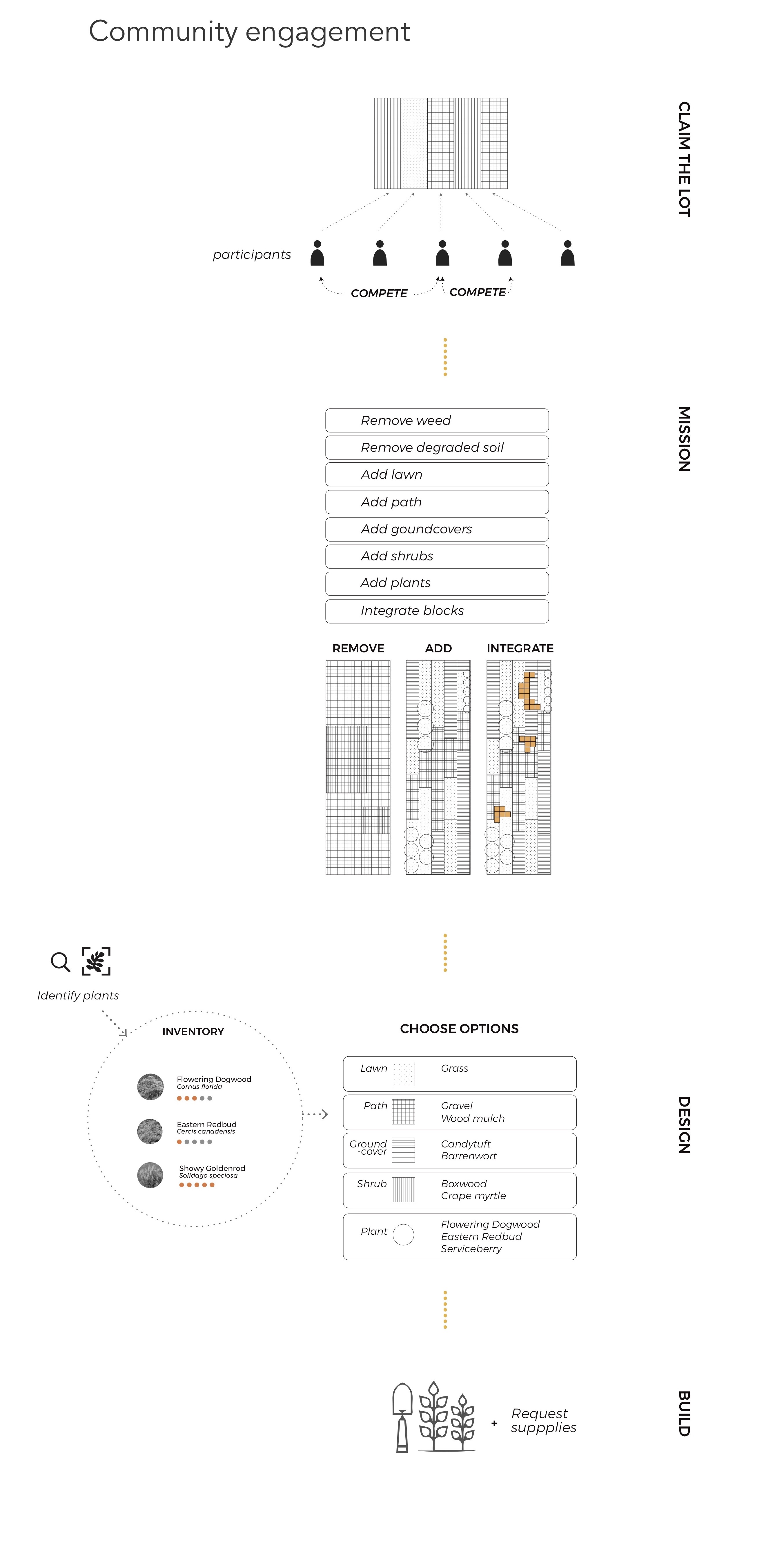
Typology
 .
. 
Cubic Garden
; who is the owner of this land?Duration: 1 month
Tools: Adobe Illustrator, Adobe Photoshop, AutoCAD, SketchUp
> Who is the owner of this land?
| Problem |
The local residents’ convenience was never considered as a primary concern while the area became popular among tourists and gentrified.
| Goal |
Utilizing the slope for both tourists and the local residents while dividing their circulations.
Background
Ihwa-dong is a hilly residential area of Seoul. As a part of a 2006 cultural rehabilitation project, the town brought in artists to cover the stairs and walls with murals, thereby rebranded the neighborhood as a “mural village.” This project introduced an influx of visitors to the area, while local residents were severely inconvenienced due to invasions of privacy, increased garbage and noise. The local residents’ convenience was never considered as a primary concern and they eventually responded through vandalism of the murals.
This brings up the question of land ownership and whether or not the needs of residents and visitors can coexist. Addressing this issue begins with the dualization of subject and object. Visitors and residents are divided without being aware of the possibility for interaction between one another.
Inspiration & motivation
A simple programmatic approach for solving a problem, without considering a physical environment, would create confusion. The composition of Cubic garden guarantees the private space of residents by separating the pathways of visitors from the living space of residents. In residential buildings, the collision of visitors and residents is prevented by separating rooftop space and residential space. This physical division paradoxically breaks the boundaries between the two cohorts. Additionally, by providing a common community space between subjects and objects, the boundary between how visitors and residents perceive the community’s slopes is weakened.
In this hilly community space, the concept of space is blurred as visitors treat the slopes as a viewpoint, while residents continue to view it simply as a slope. The collapse of a dichotomy from the decaying boundary creates a rhizome form through the interactions of both residents and visitors and allows the possibility of creating events in the space. The concepts of subject/object and resident/visitor become increasingly blurred.
Strategy: module
Strategy: circulation
Plan
︎︎︎ Go Back
Aquifer Recharge
; rainfall and drought in CubaHarvard Graduate School of Design | 2018
Instructor: Danielle Choi Team: Sunmee Lee
Duration: 3 months
Role: Research, Mapping, Drawings, Video
Tools: Arc GIS, Rhino, Adobe Illustrator, Adobe Photoshop, Adobe AfterEffect
> How do we resolve the drought issue with existing infrastructure in Cuba?
| Problem |
In Cuba, the massive construction of dams caused the decline in the volume of groundwater held in aquifers, given that these dams divert the surface water into the massive reservoir.
| Goal |
This project provides landscape strategies that will serve as new sources of water management in the region.
>> Questioning the inefficiency of the Jaibo Dam and channel and using them to recharge the aquifer.
Background
Under the Cuban revolutionary government, dams and irrigation channels were actively constructed to control water supply for agriculture and to minimize water shortage in the dry seasons. In spite of the instant satisfaction to the water demand, it has extensively intervened in the original water system. It caused the decline in the volume of groundwater held in aquifers, given that these dams divert the surface water into the massive reservoir.
 This infrastructure is located north of Guantanamo city, running a distance of 20km.
Research
| Water Flow |
 The surface water flow in Guantanamo Basin
The ground water flow in Guantanamo Basin
| Jaibo Channel |

 A scenario with the clayland in drought conditions.
 Review Exhibition


***
Tobacco Research


Production
| Cigar |
| Cigarrete |
Crop Rotation
Tobacco | Corn | Sugarcane | Prickly pear
Nodes and Pauses
Individual Project | 2016
Duration: 1 months
Tools: Auto CAD, Adobe Illustrator, Adobe Photoshop
Model Making: Laser Cutting, Plaster Casting
> Is habituation breakable?
Description
an accumulated time that flows into the past from the present.
All of these function as landmarks, but the way of connecting them only exists as a space of passage. In routine environments,
people’s memories become habitual and the flow of these memories remains locked in the consciousness and in the form of another axis.
The transformed axes in these historical gaps have been superimposed again with fragments of past memories. The buoys of memory created in the course of this superposition are represented by nodes and landmarks.
These nodes break the current and past boundaries by pausing the present, and induce dishabituation in this already habituated space.
It appears as a new superposition in the form of an organic axis breathing with the periphery. The destroyed boundaries of time also break down the axis of people’s flow, allowing people to rearrange and extend the realm of perception to the periphery. This extended range of memories is another flow in and of itself, repeating
habituation, dishabituation, and reterritorialization.
Background
The memory fragments have been superimposed over time for a long time, each of them being a patch-like memory point.
 From the past to the present of this place
Dishabituation
Nodes that are made by everyday space give pause to people and interact with themselves to create an organic relationship with the surroundings.